Innovation in Service of Society:
High-Tech Geodetic Equipment Explores Seismic Potential in Northwestern Bulgaria
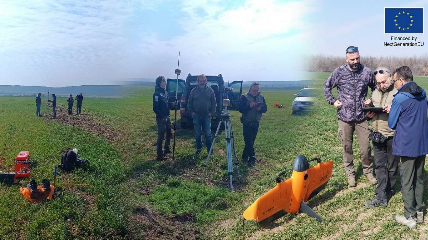
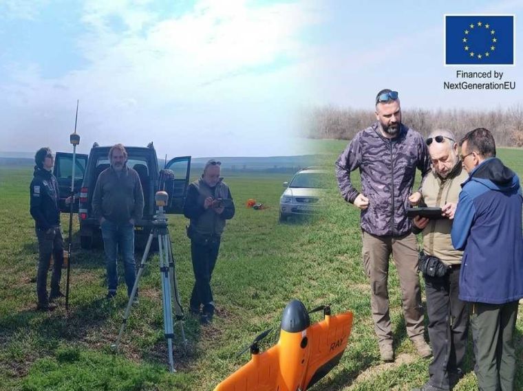
As part of the large-scale investment BG-RRP-2.011-0010 under the National Recovery and Resilience Plan, the leading geodetic services company Geovara has delivered specialized high-tech equipment to the Geological Institute of the Bulgarian Academy of Sciences (BAS). This project is implemented with the financial support of the European Union through the NextGenerationEU instrument.
The delivered apparatus represents a pinnacle in modern geodesy, combining extreme precision with the high durability required for operations in harsh climatic conditions and challenging terrains:
WingtraRay Drone: A professional unmanned aerial platform with Vertical Take-Off and Landing (VTOL) capabilities. It provides unprecedented accuracy in aerial mapping and is engineered to operate reliably even in challenging weather conditions.
Topcon GNSS Systems: High-precision terrestrial receivers for geodetic surveying that guarantee millimeter-level data accuracy. These systems feature high-grade protection against dust, moisture, and extreme temperatures.
The equipment has already proven its effectiveness and reliability in the field. It was used to collect unique, qualitatively new data from a section of the largest fault line in Northwestern Bulgaria. This data allows for a detailed analysis that was previously impossible using conventional methods.
"The goal of this study is to establish the seismic potential of the fault with high precision. This is critically important information not only for science but also for the overall security of the region," stated Dr. Donkova from the project implementation team.
The results of this project will have a direct impact on better infrastructure and investment planning, ensuring alignment with environmental standards and seismic hazard assessments.