![]()
![]()
![]()
![]()
![]()
![]()
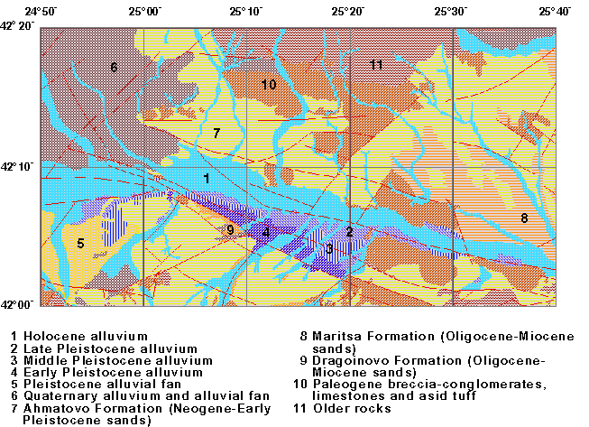 |
The Thrace depression is limited to the south by the Rhodope Mountains, and to the north by the Sredna Gora Mountains. Neogene and Quaternary deposits fill the depression. These deposits cover older, mainly Paleogene, sedimentary and volcanic rocks. The thickness of the young deposits riches several hundred meters in central part of the depression. The sedimentation during Neogene and Quaternary time is controlled by WNWESE and EW striking faults. |
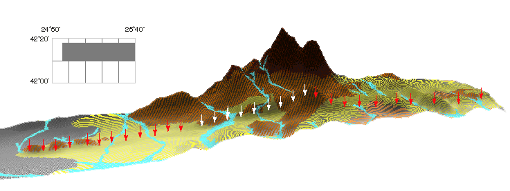 |
The Chirpan fault is a normal south-dipping fault. Its length is at least 56 km, and most probably it continuos eastward. Because of differences in the description of the rupture produced by 14th April 1928 earthquake, we know only that displacement occurs along a 12 km segment northwards from the town of Chirpan (white arrows on the picture). |